-
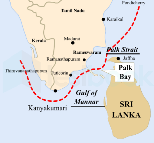
Palk Bay is a semi-enclosed shallow water body between the southeast coast of India and Sri Lanka, with a water depth maximum of 13 m
-
The width of Palk Bay ranges from 57 to 107 km and the length is around 150 km.
-
It has been a source of dispute for long.
-
Efforts for delimitation of the Palk strait and Gulf of Mannar had started since 1921, but the agreements were finally signed in 1970 only.
-
The concept of International Maritime Boundary Line (IMBL) for Palk strait came into being through these agreements.
-
The IMBL made some former parts of India, a part of Sri Lanka.
-
So even these agreements were not free from disputes and thus could not settle the issue boundary and fishing jurisdictions permanently.
-
These loopholes in the pacts gave way to new problems, including the recurring incidents of Tamil Nadu fishermen crossing the IMBL and getting caught by the Sri Lankan authorities.
