-
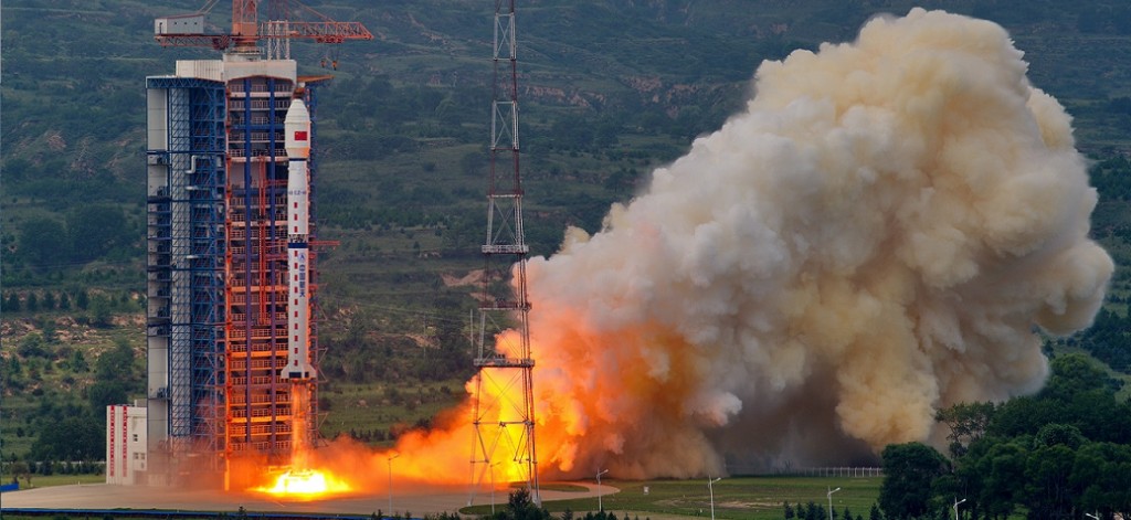
It is an optical remote sensing satellite launched by China.
-
It will become part of China High-resolution Earth Observation System (CHEOS) initiated in 2010 to provide all-weather, all-day coverage by 2020.
-
It will be used for land survey, urban planning, road network design, agriculture, and disaster relief.
ÎÒ¹ú³É¹¦·¢Éä¸ß·ÖʮһºÅÎÀÐÇ
7ÔÂ31ÈÕ11ʱ£¬ÎÒ¹úÔÚÌ«ÔÎÀÐÇ·¢ÉäÖÐÐÄÓó¤Õ÷ËĺÅÒÒÔËÔØ»ð¼ý£¬³É¹¦½«¸ß·ÖʮһºÅÎÀÐÇ·¢ÉäÉý¿Õ£¬ÎÀÐǽøÈëÔ¤¶¨¹ìµÀ¡£
лªÉç¼ÇÕß ²ÜÑô Éã